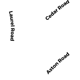
173 LAUREL RD
Owner Information
FRANKEL DAVID & TRACEY
173 LAUREL RD
CHESTNUT HILL, MA 02467


Property Details
173 LAUREL RD is classified as a Single Family Residential (Cape).
The primary structure on this property was built in 1948. There is 6,412ft2 of residential/living space within this property. This property is listed as having 13 rooms.
173 LAUREL RD is valued at $3,627,300. The land is valued at $1,360,300 and the structures are valued at $2,267,000.
This property is in Zone S15. Confirm with local Zoning Board authorities to ensure there are no overlays or other easements on this property.
The most recent deed for 173 LAUREL RD is recorded at the local registrar in Book 29397, Page 225. 173 LAUREL RD was last sold on Thursday, December 1, 2011 for $2,940,000.
Assessment data from fiscal year 2021.
Flood Data
According to the FEMA National Flood Hazard Layer, this property does not appear to be in a flood zone. It may also be in an area not yet reviewed. Nonetheless, confirm this information prior to taking any action.
To view the flood hazards around this property, create a FEMA "Firmette" Map of the area around 173 LAUREL RD.
Broadband Internet Providers
| Provider | Type | Bandwidth (mbps) | |
|---|---|---|---|
| Verizon New England Inc. | DSL | 5 | 0 |
| GCI Communication Corp. | Satellite | 0 | 0 |
| HughesNet | Satellite | 25 | 3 |
| T-Mobile | Fixed Wireless | 25 | 3 |
| RCN | Cable | 1000 | 20 |
| RCN | Cable | 500 | 20 |
| Comcast | Cable | 1000 | 35 |
| VSAT Systems, LLC. | Satellite | 2 | 1 |
| Crown Castle Fiber | Fiber | 0 | 0 |
| Viasat Inc | Satellite | 100 | 3 |
Broadband service provider data from December 2020.
Adjacent Properties
- 181 LAUREL RD
Single Family Residential owned by PUNWANI VIKRAM S - 167 LAUREL RD
Single Family Residential owned by SLOANE TR MARSHALL M - 75 HAMMOND POND PKY
Single Family Residential owned by GROIPEN PAUL - 231 HAMMOND POND PKY
Dept. of Conservation and Recreation (DCR) - Division of Urban Parks and Recreation (non-reimbursable) owned by COMMONWEALTH OF MASSACHUSETTS